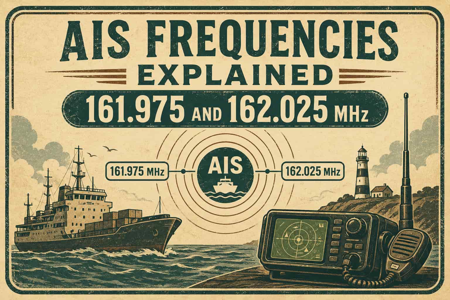
Every ship you’ve ever seen tracked live on a map online, whether on MarineTraffic, VesselFinder, or a hobbyist’s home setup, is being located using two specific VHF frequencies: 161.975 MHz and 162.025 MHz. These two channels carry the entire global Automatic Identification System, the maritime tracking network that lets ships, coast stations, and satellites see exactly where nearby vessels are, where they’re heading, and how fast they’re moving. This guide breaks down exactly what these frequencies are, why there are two of them, and how the system built on top of them actually works.
The Two AIS Channels
AIS 1: 161.975 MHz, internationally designated as marine VHF Channel 87B (sometimes labeled Channel 2087).
AIS 2: 162.025 MHz, internationally designated as marine VHF Channel 88B (sometimes labeled Channel 2088).
Both frequencies are defined under ITU-R M.1371, the international technical standard governing AIS, and are used identically worldwide as the default AIS channel pair under International Maritime Organization regulations. Some regional administrations have historically been authorized to designate alternative channel pairs for AIS use in specific geographic areas, but 161.975 and 162.025 MHz remain the global default that virtually every AIS transponder and receiver is built around.
Why Two Channels Instead of One
AIS transmits on both frequencies simultaneously rather than choosing one, and the reason comes down to capacity and redundancy rather than range or signal quality. A single VHF channel has a hard ceiling on how many vessels can transmit position reports without messages colliding with each other, and busy shipping lanes, ports, and strait crossings can have hundreds of vessels within VHF range of one another at once. Splitting traffic across two channels roughly doubles the system’s total capacity to handle that vessel density without overwhelming the channel.
The dual-channel design also provides resilience. If interference, a faulty transmitter, or local conditions degrade one channel in a particular area, vessels using the second channel are unaffected, and most AIS receivers monitor both channels simultaneously so reception isn’t dependent on either one alone.
How Data Actually Moves Over These Frequencies
AIS uses Gaussian Minimum Shift Keying (GMSK) modulation, the same modulation family used in GSM cellular networks, transmitting at 9,600 bits per second on each channel. What makes AIS work reliably in a shared, uncoordinated environment is the access scheme layered on top of that modulation.
Each AIS channel is divided into 2,250 time slots per minute, each slot lasting roughly 26.7 milliseconds. Class A transponders, the type mandated on commercial vessels, use Self-Organized Time Division Multiple Access (SOTDMA), where each vessel predicts which time slots are likely to be free based on the position reports it has already received from nearby ships, then reserves a slot for its own upcoming transmission and broadcasts that reservation in advance so other vessels avoid it. This self-organizing structure is what lets thousands of vessels share two channels without a central coordinator assigning slots.
Class B transponders, typically used on recreational and smaller commercial vessels, use a simpler Carrier-Sense TDMA (CSTDMA) approach, listening for an open slot and transmitting opportunistically rather than reserving slots in advance, which uses less transmitter complexity at the cost of slightly lower reliability in very congested traffic.
Where AIS Sits in the Marine VHF Band
The international marine VHF band spans roughly 156.025 to 162.025 MHz, organized into channels with 25 kHz spacing (some regions use 12.5 kHz channel spacing for additional capacity). AIS occupies the very top of this range, channels 87 and 88, which were originally allocated for other maritime VHF purposes before being repurposed specifically for AIS as the system was standardized internationally in the early 2000s.
| Channel | Frequency | Use |
|---|---|---|
| 75 | 156.775 MHz | AIS Application Specific Messages, AIS-SART, AtoN (regional) |
| 76 | 156.825 MHz | AIS Application Specific Messages, AIS-SART, AtoN (regional) |
| 87B | 161.975 MHz | AIS 1 (primary global AIS channel) |
| 88B | 162.025 MHz | AIS 2 (primary global AIS channel) |
Other Devices Sharing These Frequencies
The two primary AIS channels aren’t used exclusively by ship transponders. AIS-SART (Search and Rescue Transmitter) devices, carried as emergency beacons on life rafts and lifeboats, transmit a distinctive series of position reports on the same two channels when activated, appearing on nearby ships’ AIS displays as a clear distress marker rather than a normal vessel target. AtoN (Aids to Navigation) stations, both physical buoys equipped with AIS transmitters and virtual AtoN broadcast by shore stations representing buoys or hazards that don’t have physical transmitters installed, also transmit on these same frequencies, which is why an AIS display shows not just ships but lighthouses, buoys, and charted hazards as well.
Channels 75 and 76 play a supporting role to the main two AIS channels, carrying Application Specific Messages (ASM), a more flexible data channel used for things like weather and tidal information broadcasts, as well as serving as alternate channels for AIS-SART and AtoN transmissions in some regional configurations.
VDES: The Next Layer Being Built Around AIS
The VHF Data Exchange System (VDES) is an emerging international standard designed to add significant new data capacity to maritime VHF communications without disrupting the existing AIS channels that ships already depend on. Rather than replacing 161.975 and 162.025 MHz, VDES adds new channels around them specifically to carry higher-bandwidth data like detailed weather routing, port logistics information, and satellite-relayed traffic, while explicitly protecting the original AIS channels from interference as this additional capacity is layered in. This is a useful frequency cluster to watch, since it represents the most significant evolution of the maritime VHF band in two decades, building directly on the same two-channel foundation AIS established.
Reception Range and Why the Front End Matters
AIS is a line-of-sight VHF system, so terrestrial reception range is governed by antenna height and the curvature of the earth rather than by transmitter power alone, typically reaching 20 to 40 nautical miles between two vessels or from a well-placed shore station, though signals can travel further under certain atmospheric conditions. Because AIS sits at the very top of the marine VHF band, immediately adjacent to other busy marine channels and not far in frequency terms from FM broadcast and other VHF services, a receiver’s front end matters more than people often expect. Strong nearby signals outside the AIS channels can desensitize a receiver or generate interference products that mask weak, distant AIS targets, which is exactly the scenario a properly designed bandpass filter and low-noise amplifier in front of the receiver are built to prevent.
This is also the same underlying physics that makes satellite-based AIS reception possible at all. AIS was never originally designed with satellite reception in mind, but the system’s VHF signals propagate well enough vertically that satellites in low Earth orbit have been successfully receiving AIS transmissions from these same two channels since the technique was first demonstrated in the late 2000s, extending vessel tracking coverage to open ocean areas far beyond the reach of any shore station.